
Klam topographic map
Interactive map
Click on the map to display elevation.
About this map
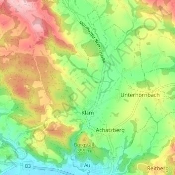
Name: Klam topographic map, elevation, terrain.
Location: Klam, Bezirk Perg, 4352, Österreich (48.21274 14.75724 48.24879 14.81820)
Average elevation: 317 m
Minimum elevation: 232 m
Maximum elevation: 430 m
Die komplette Liste der Statistik Austria ist in: Topographische Siedlungskennzeichnung nach STAT
Other topographic maps
Click on a map to view its topography, its elevation and its terrain.
Waging
Österreich > Bezirk Perg > Oberzirking
Waging, Oberzirking, Ried in der Riedmark, Bezirk Perg, 4312, Österreich
Average elevation: 291 m