
Thank you for supporting this site ❤️
Make a donation
Make a donation
Keaton Beach topographic map
Click on the map to display elevation.
Thank you for supporting this site ❤️
Make a donation
Make a donation
About this map
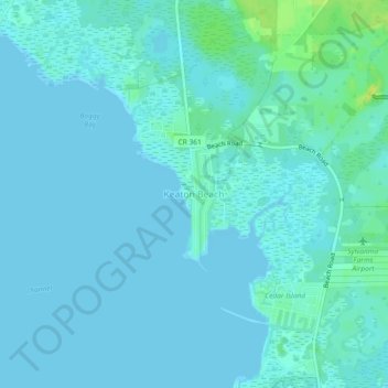
Name: Keaton Beach topographic map, elevation, terrain.
Location: Keaton Beach, Taylor County, Florida, United States (29.80530 -83.61388 29.84530 -83.57388)
Average elevation: 3 m
Minimum elevation: -1 m
Maximum elevation: 16 m
Thank you for supporting this site ❤️
Make a donation
Make a donation
Other topographic maps
Click on a map to view its topography, its elevation and its terrain.