
Thank you for supporting this site ❤️
Make a donation
Make a donation
Hickman County topographic map
Click on the map to display elevation.
Thank you for supporting this site ❤️
Make a donation
Make a donation
About this map
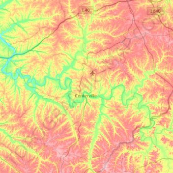
Name: Hickman County topographic map, elevation, terrain.
Location: Hickman County, Middle Tennessee, Tennessee, United States (35.60894 -87.74375 35.99307 -87.20228)
Average elevation: 213 m
Minimum elevation: 117 m
Maximum elevation: 311 m
Thank you for supporting this site ❤️
Make a donation
Make a donation
Other topographic maps
Click on a map to view its topography, its elevation and its terrain.
Thank you for supporting this site ❤️
Make a donation
Make a donation
Thank you for supporting this site ❤️
Make a donation
Make a donation
Shepherd
United States > Tennessee > Hamilton County > Chattanooga > Shepherd
Average elevation: 212 m
Thank you for supporting this site ❤️
Make a donation
Make a donation