
Toledo Port topographic map
Interactive map
Click on the map to display elevation.
About this map
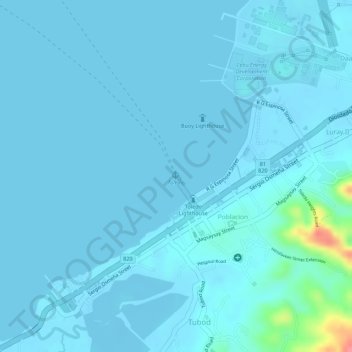
Name: Toledo Port topographic map, elevation, terrain.
Average elevation: 6 m
Minimum elevation: -2 m
Maximum elevation: 81 m
Other topographic maps
Click on a map to view its topography, its elevation and its terrain.
Toledo City Plaza
Philippines > Cebu > Toledo
Toledo City Plaza, Toledo, Cebu, Central Visayas, 6038, Philippines
Average elevation: 9 m
Malubog Dam
Philippines > Cebu > Toledo
Malubog Dam, Toledo, Cebu, Central Visayas, Philippines
Average elevation: 222 m