
Thank you for supporting this site ❤️
Make a donation
Make a donation
Ararua topographic map
Click on the map to display elevation.
Thank you for supporting this site ❤️
Make a donation
Make a donation
About this map
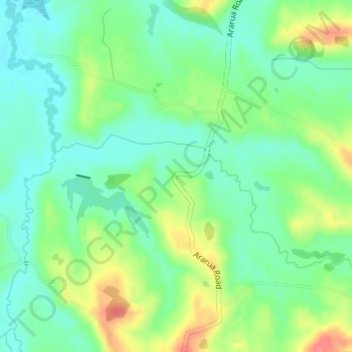
Name: Ararua topographic map, elevation, terrain.
Location: Ararua, Kaipara District, Northland, New Zealand (-36.06694 174.15874 -36.04694 174.17874)
Average elevation: 42 m
Minimum elevation: 17 m
Maximum elevation: 88 m
Thank you for supporting this site ❤️
Make a donation
Make a donation
Other topographic maps
Click on a map to view its topography, its elevation and its terrain.