
Thank you for supporting this site ❤️
Make a donation
Make a donation
South Park topographic map
Click on the map to display elevation.
Thank you for supporting this site ❤️
Make a donation
Make a donation
About this map
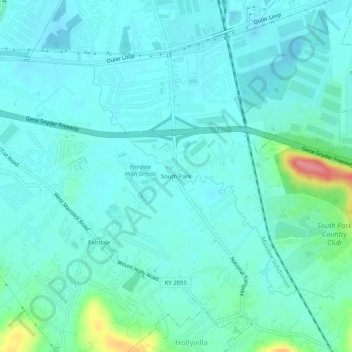
Name: South Park topographic map, elevation, terrain.
Average elevation: 149 m
Minimum elevation: 134 m
Maximum elevation: 225 m
Thank you for supporting this site ❤️
Make a donation
Make a donation
Other topographic maps
Click on a map to view its topography, its elevation and its terrain.
Jefferson Memorial Forest
United States > Kentucky > Jefferson County > Louisville
Average elevation: 164 m
Mirror Lakes
United States > Kentucky > Jefferson County > Louisville > Hopewell
Average elevation: 198 m
Thank you for supporting this site ❤️
Make a donation
Make a donation
Falls of the Ohio State Park
United States > Kentucky > Jefferson County > Louisville
Average elevation: 135 m