
Thank you for supporting this site ❤️
Make a donation
Make a donation
Rhoda Island topographic map
Click on the map to display elevation.
Thank you for supporting this site ❤️
Make a donation
Make a donation
About this map
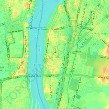
Name: Rhoda Island topographic map, elevation, terrain.
Location: Rhoda Island, El Sheikh Mubarak, Cairo, Egypt (30.00685 31.22213 30.03601 31.23037)
Average elevation: 26 m
Minimum elevation: 9 m
Maximum elevation: 45 m
Thank you for supporting this site ❤️
Make a donation
Make a donation