
Thank you for supporting this site ❤️
Make a donation
Make a donation
Aru Islands topographic map
Click on the map to display elevation.
Thank you for supporting this site ❤️
Make a donation
Make a donation
About this map
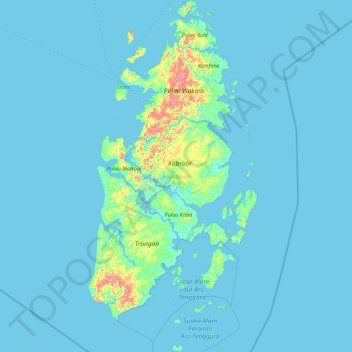
Name: Aru Islands topographic map, elevation, terrain.
Location: Aru Islands, Moluccas, Maluku, 97662, Indonesia (-7.10044 134.05170 -5.32593 134.90869)
Average elevation: 4 m
Minimum elevation: -3 m
Maximum elevation: 81 m
Thank you for supporting this site ❤️
Make a donation
Make a donation
Other topographic maps
Click on a map to view its topography, its elevation and its terrain.