
Thank you for supporting this site ❤️
Make a donation
Make a donation
Rocky Peak topographic map
Click on the map to display elevation.
Thank you for supporting this site ❤️
Make a donation
Make a donation
About this map
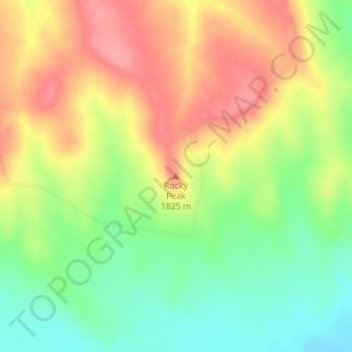
Name: Rocky Peak topographic map, elevation, terrain.
Location: Rocky Peak, Elbert County, Colorado, United States (39.30216 -104.04612 39.30226 -104.04602)
Average elevation: 1,784 m
Minimum elevation: 1,736 m
Maximum elevation: 1,833 m
Thank you for supporting this site ❤️
Make a donation
Make a donation
Other topographic maps
Click on a map to view its topography, its elevation and its terrain.
Big Sandy Creek Watershed S-16 Dam
United States > Colorado > Elbert County
Average elevation: 1,852 m