
Grey County topographic map
Interactive map
Click on the map to display elevation.
About this map
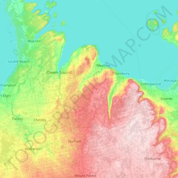
Name: Grey County topographic map, elevation, terrain.
Location: Grey County, Southwestern Ontario, Ontario, Canadá (43.96786 -81.14036 44.97331 -80.22912)
Average elevation: 288 m
Minimum elevation: 172 m
Maximum elevation: 544 m