
Thank you for supporting this site ❤️
Make a donation
Make a donation
Pratt Hill topographic map
Click on the map to display elevation.
Thank you for supporting this site ❤️
Make a donation
Make a donation
About this map
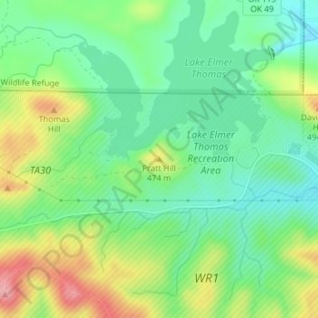
Name: Pratt Hill topographic map, elevation, terrain.
Location: Pratt Hill, Comanche County, Oklahoma, 73557, United States (34.71900 -98.52471 34.71910 -98.52461)
Average elevation: 442 m
Minimum elevation: 395 m
Maximum elevation: 523 m
Thank you for supporting this site ❤️
Make a donation
Make a donation
Other topographic maps
Click on a map to view its topography, its elevation and its terrain.
Thank you for supporting this site ❤️
Make a donation
Make a donation
Thank you for supporting this site ❤️
Make a donation
Make a donation
Thank you for supporting this site ❤️
Make a donation
Make a donation