
Isenbügel topographic map
Interactive map
Click on the map to display elevation.
About this map
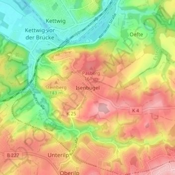
Name: Isenbügel topographic map, elevation, terrain.
Average elevation: 113 m
Minimum elevation: 36 m
Maximum elevation: 188 m
Other topographic maps
Click on a map to view its topography, its elevation and its terrain.
Abtsküche / Haus Hetterscheidt
Deutschland > Nordrhein-Westfalen > Kreis Mettmann > Heiligenhaus > Tüschen > Abtsküche / Haus Hetterscheidt
Abtsküche / Haus Hetterscheidt, Tüschen, Heiligenhaus, Kreis Mettmann, Nordrhein-Westfalen, 42579, Deutschland
Average elevation: 168 m