
Römerstadt topographic map
Interactive map
Click on the map to display elevation.
About this map
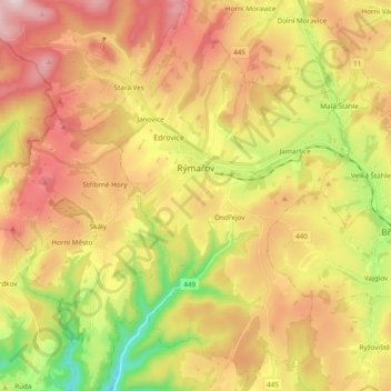
Name: Römerstadt topographic map, elevation, terrain.
Average elevation: 643 m
Minimum elevation: 349 m
Maximum elevation: 924 m
Other topographic maps
Click on a map to view its topography, its elevation and its terrain.
Zechitz
Tschechien > Mährisch-Schlesien > Römerstadt > Zechitz
Zechitz, Römerstadt, Bezirk Freudenthal, Mährisch-Schlesische Region, Mährisch-Schlesien, Tschechien
Average elevation: 647 m