
Thank you for supporting this site ❤️
Make a donation
Make a donation
Thangu Valley topographic map
Click on the map to display elevation.
Thank you for supporting this site ❤️
Make a donation
Make a donation
About this map
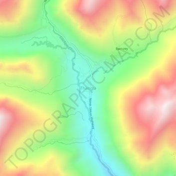
Name: Thangu Valley topographic map, elevation, terrain.
Location: Thangu Valley, Chungthang, Mangan, Sikkim, India (27.87250 88.51596 27.91250 88.55596)
Average elevation: 4,243 m
Minimum elevation: 3,733 m
Maximum elevation: 4,846 m
Thank you for supporting this site ❤️
Make a donation
Make a donation
Other topographic maps
Click on a map to view its topography, its elevation and its terrain.