
Thank you for supporting this site ❤️
Make a donation
Make a donation
Vorden topographic map
Click on the map to display elevation.
Thank you for supporting this site ❤️
Make a donation
Make a donation
About this map
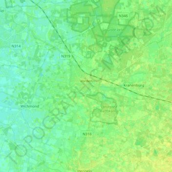
Name: Vorden topographic map, elevation, terrain.
Location: Vorden, Bronckhorst, Gelderland, Netherlands (52.06437 6.26330 52.13771 6.42400)
Average elevation: 13 m
Minimum elevation: 6 m
Maximum elevation: 20 m
Thank you for supporting this site ❤️
Make a donation
Make a donation
Other topographic maps
Click on a map to view its topography, its elevation and its terrain.
Thank you for supporting this site ❤️
Make a donation
Make a donation
Thank you for supporting this site ❤️
Make a donation
Make a donation
Thank you for supporting this site ❤️
Make a donation
Make a donation