
Wangen-Brüttisellen topographic map
Interactive map
Click on the map to display elevation.
About this map
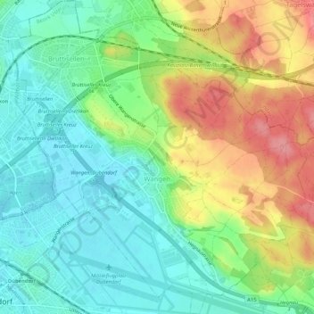
Name: Wangen-Brüttisellen topographic map, elevation, terrain.
Location: Wangen-Brüttisellen, Bezirk Uster, Zürich, Zwitserland (47.39555 8.62205 47.43077 8.67094)
Average elevation: 466 m
Minimum elevation: 431 m
Maximum elevation: 523 m
Other topographic maps
Click on a map to view its topography, its elevation and its terrain.
Uster
Zwitserland > Zürich > Bezirk Uster
Uster, Bezirk Uster, Zürich, Zwitserland
Average elevation: 487 m