
Exter topographic map
Interactive map
Click on the map to display elevation.
About this map
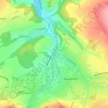
Name: Exter topographic map, elevation, terrain.
Average elevation: 208 m
Minimum elevation: 151 m
Maximum elevation: 281 m
Other topographic maps
Click on a map to view its topography, its elevation and its terrain.
Linderhofe
Deutschland > Nordrhein-Westfalen > Extertal > Linderhofe
Linderhofe, Extertal, Kreis Lippe, Nordrhein-Westfalen, 32694, Deutschland
Average elevation: 275 m