
Dassel topographic map
Interactive map
Click on the map to display elevation.
About this map
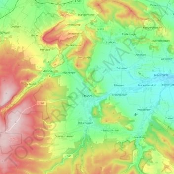
Name: Dassel topographic map, elevation, terrain.
Location: Dassel, Landkreis Northeim, Nedersaksen, 37586, Duitsland (51.73707 9.57882 51.88157 9.79949)
Average elevation: 278 m
Minimum elevation: 121 m
Maximum elevation: 531 m