
Maurage topographic map
Interactive map
Click on the map to display elevation.
About this map
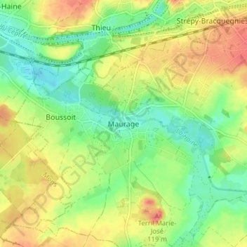
Name: Maurage topographic map, elevation, terrain.
Location: Maurage, La Louvière, Hainaut, Wallonie, 7110, Belgique (50.43773 4.07799 50.47773 4.11799)
Average elevation: 66 m
Minimum elevation: 40 m
Maximum elevation: 97 m