
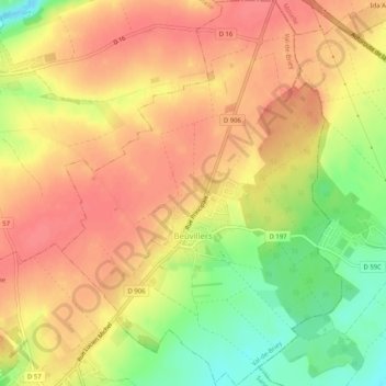
Bockweiler topographic map
Interactive map
Click on the map to display elevation.
About this map
Name: Bockweiler topographic map, elevation, terrain.
Average elevation: 367 m
Minimum elevation: 325 m
Maximum elevation: 390 m
Other topographic maps
Click on a map to view its topography, its elevation and its terrain.
La Schleide
Frankreich > Großer Osten > Mörthe und Mosel > Bergheim
La Schleide, Bergheim, Val-de-Briey, Mörthe und Mosel, Großer Osten, Metropolitanes Frankreich, 54190, Frankreich
Average elevation: 413 m
Dieulouard
Frankreich > Großer Osten > Mörthe und Mosel
Dieulouard, Nancy, Mörthe und Mosel, Großer Osten, Metropolitanes Frankreich, 54380, Frankreich
Average elevation: 226 m
Raucourt
Frankreich > Großer Osten > Mörthe und Mosel
Raucourt, Nancy, Mörthe und Mosel, Großer Osten, Metropolitanes Frankreich, 54610, Frankreich
Average elevation: 225 m
Les Noires Colas
Frankreich > Großer Osten > Mörthe und Mosel > Bionville > Les Noires Colas
Les Noires Colas, Bionville, Lünstadt, Mörthe und Mosel, Großer Osten, Metropolitanes Frankreich, 54540, Frankreich
Average elevation: 471 m
Langstein
Frankreich > Großer Osten > Mörthe und Mosel > Langstein
Langstein, Lünstadt, Mörthe und Mosel, Großer Osten, Metropolitanes Frankreich, 54540, Frankreich
Average elevation: 403 m
Bergweiler
Frankreich > Großer Osten > Mörthe und Mosel > Bergweiler
Bergweiler, Briey, Mörthe und Mosel, Großer Osten, Metropolitanes Frankreich, 54920, Frankreich
Average elevation: 378 m
Ludres
Frankreich > Großer Osten > Mörthe und Mosel > Ludres
Ludres, Nancy, Mörthe und Mosel, Großer Osten, Metropolitanes Frankreich, 54710, Frankreich
Average elevation: 309 m
Laxou
Frankreich > Großer Osten > Mörthe und Mosel > Laxou
Laxou, Nancy, Mörthe und Mosel, Großer Osten, Metropolitanes Frankreich, 54520, Frankreich
Average elevation: 280 m
Tellancourt
Frankreich > Großer Osten > Mörthe und Mosel
Tellancourt, Briey, Mörthe und Mosel, Großer Osten, Metropolitanes Frankreich, 54260, Frankreich
Average elevation: 375 m