
Make a donation
Qit'at al-Buleil topographic map
Click on the map to display elevation.
Make a donation
About this map
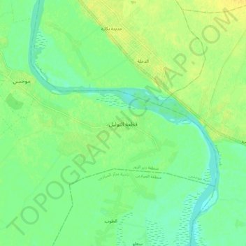
Name: Qit'at al-Buleil topographic map, elevation, terrain.
Average elevation: 196 m
Minimum elevation: 186 m
Maximum elevation: 207 m
Make a donation
Other topographic maps
Click on a map to view its topography, its elevation and its terrain.
Deir ez-Zor
Syria > Deir ez-Zor Governorate
From 10 April 2016 to 31 August 2017, the World Food Programme supplied the city with food and essential relief items through a high-altitude airdrop service. With a Russian contracted Il-76 aircraft and parachute systems provided by Canada, the US, and Russia, a total of 8015 pallets with an average weight of…
Average elevation: 214 m