
Gemeinde Wängle topographic map
Interactive map
Click on the map to display elevation.
About this map
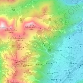
Name: Gemeinde Wängle topographic map, elevation, terrain.
Location: Gemeinde Wängle, Bezirk Reutte, Tirol, 6610, Oostenrijk (47.47600 10.63246 47.50382 10.70762)
Average elevation: 1,331 m
Minimum elevation: 837 m
Maximum elevation: 2,221 m