
Thank you for supporting this site ❤️
Make a donation
Make a donation
Khaireni topographic map
Click on the map to display elevation.
Thank you for supporting this site ❤️
Make a donation
Make a donation
About this map
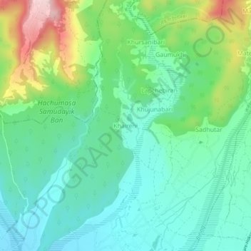
Name: Khaireni topographic map, elevation, terrain.
Location: Khaireni, Arjundhara, Jhapa, Koshi Province, Nepal (26.73232 87.98306 26.77232 88.02306)
Average elevation: 255 m
Minimum elevation: 177 m
Maximum elevation: 449 m
Thank you for supporting this site ❤️
Make a donation
Make a donation
Other topographic maps
Click on a map to view its topography, its elevation and its terrain.