
Thank you for supporting this site ❤️
Make a donation
Make a donation
Portland topographic map
Click on the map to display elevation.
Thank you for supporting this site ❤️
Make a donation
Make a donation
About this map
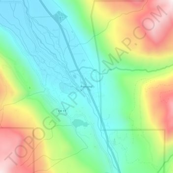
Name: Portland topographic map, elevation, terrain.
Location: Portland, Ouray County, Colorado, United States (38.06138 -107.72145 38.10138 -107.68145)
Average elevation: 2,478 m
Minimum elevation: 2,175 m
Maximum elevation: 3,041 m
Thank you for supporting this site ❤️
Make a donation
Make a donation
Other topographic maps
Click on a map to view its topography, its elevation and its terrain.