
Thank you for supporting this site ❤️
Make a donation
Make a donation
Cindrel topographic map
Click on the map to display elevation.
Thank you for supporting this site ❤️
Make a donation
Make a donation
About this map
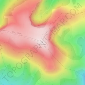
Name: Cindrel topographic map, elevation, terrain.
Location: Cindrel, Săliște, Sibiu, Roumanie (45.57856 23.80181 45.57866 23.80191)
Average elevation: 2,011 m
Minimum elevation: 1,694 m
Maximum elevation: 2,240 m
Thank you for supporting this site ❤️
Make a donation
Make a donation
Other topographic maps
Click on a map to view its topography, its elevation and its terrain.