
Thank you for supporting this site ❤️
Make a donation
Make a donation
Mâchefer topographic map
Click on the map to display elevation.
Thank you for supporting this site ❤️
Make a donation
Make a donation
About this map
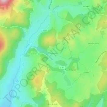
Name: Mâchefer topographic map, elevation, terrain.
Average elevation: 403 m
Minimum elevation: 296 m
Maximum elevation: 622 m
Thank you for supporting this site ❤️
Make a donation
Make a donation
Other topographic maps
Click on a map to view its topography, its elevation and its terrain.
Château de La Roche
France > Bourgogne-Franche-Comté > Nièvre > Larochemillay
Average elevation: 400 m