
Thank you for supporting this site ❤️
Make a donation
Make a donation
Pantane topographic map
Click on the map to display elevation.
Thank you for supporting this site ❤️
Make a donation
Make a donation
About this map
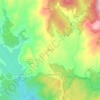
Name: Pantane topographic map, elevation, terrain.
Location: Pantane, Taverna, Catanzaro, Calabria, Italia (39.08231 16.51938 39.12231 16.55938)
Average elevation: 1,223 m
Minimum elevation: 1,039 m
Maximum elevation: 1,470 m
Thank you for supporting this site ❤️
Make a donation
Make a donation
Other topographic maps
Click on a map to view its topography, its elevation and its terrain.