
Thank you for supporting this site ❤️
Make a donation
Make a donation
Plas Madoc topographic map
Click on the map to display elevation.
Thank you for supporting this site ❤️
Make a donation
Make a donation
About this map
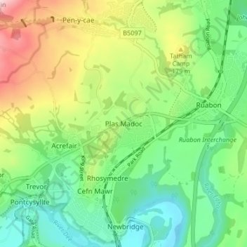
Name: Plas Madoc topographic map, elevation, terrain.
Location: Plas Madoc, Wrexham, Wales, LL14 3AU, United Kingdom (52.96409 -3.08444 53.00409 -3.04444)
Average elevation: 135 m
Minimum elevation: 46 m
Maximum elevation: 296 m
Thank you for supporting this site ❤️
Make a donation
Make a donation
Other topographic maps
Click on a map to view its topography, its elevation and its terrain.