
Bristen topographic map
Interactive map
Click on the map to display elevation.
About this map
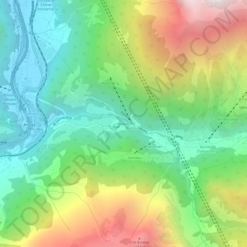
Name: Bristen topographic map, elevation, terrain.
Location: Bristen, Silenen, Uri, 6475, Suisse (46.74943 8.67181 46.78943 8.71181)
Average elevation: 1,218 m
Minimum elevation: 495 m
Maximum elevation: 2,484 m
Other topographic maps
Click on a map to view its topography, its elevation and its terrain.