
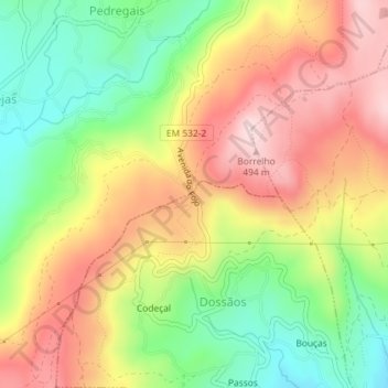
Fojo topographic map
Interactive map
Click on the map to display elevation.
About this map
Name: Fojo topographic map, elevation, terrain.
Location: Fojo, Dossãos, Vila Verde, Braga, 4730-200, Portugal (41.67762 -8.48105 41.69762 -8.46105)
Average elevation: 336 m
Minimum elevation: 185 m
Maximum elevation: 489 m