
Thank you for supporting this site ❤️
Make a donation
Make a donation
Bristol County topographic map
Click on the map to display elevation.
Thank you for supporting this site ❤️
Make a donation
Make a donation
About this map
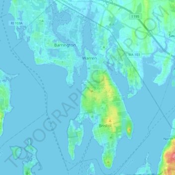
Name: Bristol County topographic map, elevation, terrain.
Location: Bristol County, Rhode Island, United States (41.63814 -71.36418 41.77614 -71.20829)
Average elevation: 6 m
Minimum elevation: -7 m
Maximum elevation: 92 m
Thank you for supporting this site ❤️
Make a donation
Make a donation
Other topographic maps
Click on a map to view its topography, its elevation and its terrain.