
Thank you for supporting this site ❤️
Make a donation
Make a donation
Wolfhagen topographic map
Click on the map to display elevation.
Thank you for supporting this site ❤️
Make a donation
Make a donation
About this map
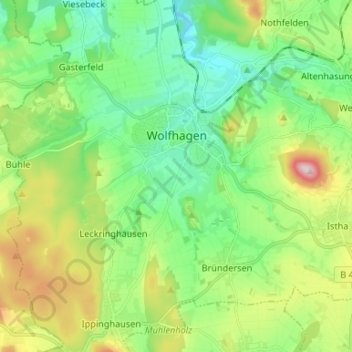
Name: Wolfhagen topographic map, elevation, terrain.
Location: Wolfhagen, Landkreis Kassel, Hesse, 34466, Germany (51.27475 9.09962 51.35756 9.22332)
Average elevation: 314 m
Minimum elevation: 220 m
Maximum elevation: 518 m
Thank you for supporting this site ❤️
Make a donation
Make a donation
Other topographic maps
Click on a map to view its topography, its elevation and its terrain.