
Cohutta Springs topographic map
Interactive map
Click on the map to display elevation.
About this map
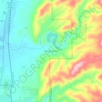
Name: Cohutta Springs topographic map, elevation, terrain.
Location: Cohutta Springs, Murray County, Georgia, 30711, USA (34.86786 -84.74716 34.90786 -84.70716)
Average elevation: 314 m
Minimum elevation: 231 m
Maximum elevation: 457 m