
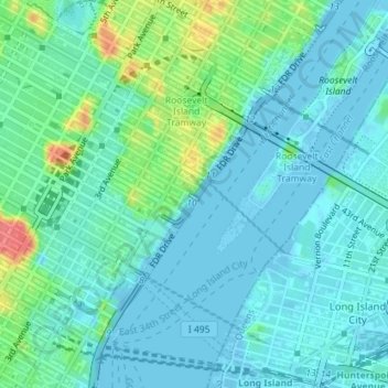
Peter Detmold Park Dog Run topographic map
Interactive map
Click on the map to display elevation.
About this map
Name: Peter Detmold Park Dog Run topographic map, elevation, terrain.
Average elevation: 14 m
Minimum elevation: -9 m
Maximum elevation: 63 m
Other topographic maps
Click on a map to view its topography, its elevation and its terrain.
Staten Island
États-Unis d'Amérique > New York > New York
Staten Island, Richmond County, New York, États-Unis d'Amérique
Average elevation: 11 m
Manhattan
États-Unis d'Amérique > New York > New York
Chinatown, Manhattan Community Board 3, Manhattan, New York County, New York, États-Unis d'Amérique
Average elevation: 12 m
BK
États-Unis d'Amérique > New York > New York
BK, Kings County, New York, États-Unis d'Amérique
Average elevation: 10 m
Kings County
États-Unis d'Amérique > New York > New York
Kings County, New York, États-Unis d'Amérique
Average elevation: 9 m
New York County
États-Unis d'Amérique > New York > New York
New York County, New York, États-Unis d'Amérique
Average elevation: 16 m