
Thank you for supporting this site ❤️
Make a donation
Make a donation
Chandan Tekdi topographic map
Click on the map to display elevation.
Thank you for supporting this site ❤️
Make a donation
Make a donation
About this map
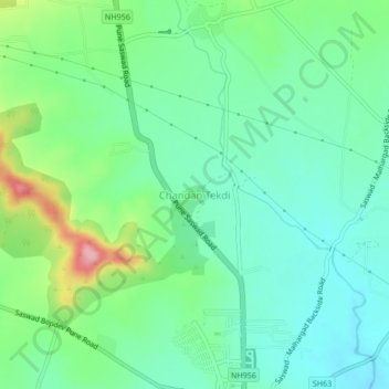
Name: Chandan Tekdi topographic map, elevation, terrain.
Location: Chandan Tekdi, Purandhar, Maharashtra, 412301, India (18.34768 74.00340 18.38768 74.04340)
Average elevation: 794 m
Minimum elevation: 751 m
Maximum elevation: 900 m
Thank you for supporting this site ❤️
Make a donation
Make a donation