
Thank you for supporting this site ❤️
Make a donation
Make a donation
Mitchel Troy topographic map
Click on the map to display elevation.
Thank you for supporting this site ❤️
Make a donation
Make a donation
About this map
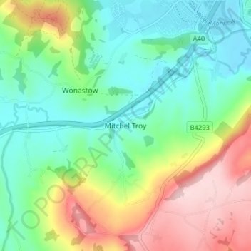
Name: Mitchel Troy topographic map, elevation, terrain.
Location: Mitchel Troy, Monmouthshire, Wales, NP25 4HZ, United Kingdom (51.76935 -2.75671 51.80935 -2.71671)
Average elevation: 101 m
Minimum elevation: 14 m
Maximum elevation: 264 m
Thank you for supporting this site ❤️
Make a donation
Make a donation
Other topographic maps
Click on a map to view its topography, its elevation and its terrain.
Thank you for supporting this site ❤️
Make a donation
Make a donation
Thank you for supporting this site ❤️
Make a donation
Make a donation