
Sullivan County topographic map
Interactive map
Click on the map to display elevation.
About this map
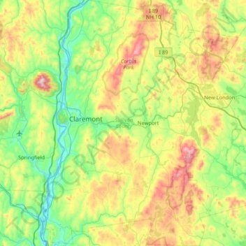
Name: Sullivan County topographic map, elevation, terrain.
Location: Sullivan County, New Hampshire, United States (43.12880 -72.45294 43.60027 -71.93527)
Average elevation: 344 m
Minimum elevation: 81 m
Maximum elevation: 932 m
Other topographic maps
Click on a map to view its topography, its elevation and its terrain.
Bedford
United States > New Hampshire > Hillsborough County
Bedford, Hillsborough County, New Hampshire, 03110, United States
Average elevation: 97 m
Bank
United States > New Hampshire > Hillsborough County > New Ipswich
Bank, New Ipswich, Hillsborough County, New Hampshire, 03071, United States
Average elevation: 312 m
Warner
United States > New Hampshire > Merrimack County
Warner, Merrimack County, New Hampshire, United States
Average elevation: 247 m
Cheshire County
Cheshire County, New Hampshire, United States
Average elevation: 308 m