
Munai topographic map
Interactive map
Click on the map to display elevation.
About this map
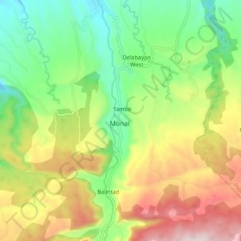
Name: Munai topographic map, elevation, terrain.
Location: Munai, Lanao del Norte, Northern Mindanao, Philippines (8.03968 124.01282 8.11968 124.09282)
Average elevation: 520 m
Minimum elevation: 251 m
Maximum elevation: 908 m
Munai has govern by Sultanate before and still adopting the rules and regulations of Sultanate. The Center of the Munai is surround by elevation and mountains, and athmosphere which attraction for the local Tourist. There are two (2) huge natural springs jointly together going street to Pagayawan Falls in Municipality of Bacolod.