
Thank you for supporting this site ❤️
Make a donation
Make a donation
Immenstedt topographic map
Click on the map to display elevation.
Thank you for supporting this site ❤️
Make a donation
Make a donation
About this map
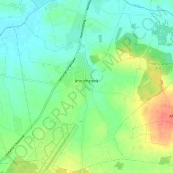
Name: Immenstedt topographic map, elevation, terrain.
Location: Immenstedt, Viöl, Nordfriesland, Sleeswijk-Holstein, Duitsland (54.51494 9.12977 54.56055 9.20956)
Average elevation: 17 m
Minimum elevation: 1 m
Maximum elevation: 47 m
Thank you for supporting this site ❤️
Make a donation
Make a donation
Other topographic maps
Click on a map to view its topography, its elevation and its terrain.
Westerheide
Duitsland > Sleeswijk-Holstein > Nordfriesland > List auf Sylt > Westerheide
Average elevation: 2 m
Thank you for supporting this site ❤️
Make a donation
Make a donation