
Thank you for supporting this site ❤️
Make a donation
Make a donation
Gene Autry topographic map
Click on the map to display elevation.
Thank you for supporting this site ❤️
Make a donation
Make a donation
About this map
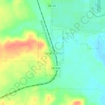
Name: Gene Autry topographic map, elevation, terrain.
Location: Gene Autry, Carter County, Oklahoma, 73436, United States (34.27793 -97.04257 34.28978 -97.03490)
Average elevation: 231 m
Minimum elevation: 212 m
Maximum elevation: 261 m
Thank you for supporting this site ❤️
Make a donation
Make a donation
Other topographic maps
Click on a map to view its topography, its elevation and its terrain.