
Betma topographic map
Interactive map
Click on the map to display elevation.
About this map
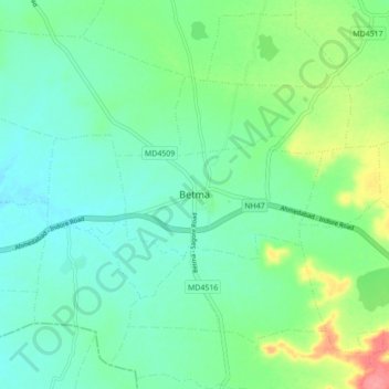
Name: Betma topographic map, elevation, terrain.
Average elevation: 551 m
Minimum elevation: 529 m
Maximum elevation: 612 m
Betma is located at 22°41′N 75°37′E / 22.68°N 75.62°E / 22.68; 75.62. It has an average elevation of 541 metres (1774 feet).