
Thank you for supporting this site ❤️
Make a donation
Make a donation
Soapstone Mountain topographic map
Click on the map to display elevation.
Thank you for supporting this site ❤️
Make a donation
Make a donation
About this map
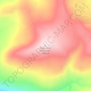
Name: Soapstone Mountain topographic map, elevation, terrain.
Location: Soapstone Mountain, Wasatch County, Utah, United States (40.52990 -111.05716 40.53000 -111.05706)
Average elevation: 2,720 m
Minimum elevation: 2,393 m
Maximum elevation: 2,895 m
Thank you for supporting this site ❤️
Make a donation
Make a donation
Other topographic maps
Click on a map to view its topography, its elevation and its terrain.