
Thank you for supporting this site ❤️
Make a donation
Make a donation
Pulung topographic map
Click on the map to display elevation.
Thank you for supporting this site ❤️
Make a donation
Make a donation
About this map
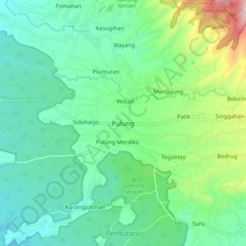
Name: Pulung topographic map, elevation, terrain.
Location: Pulung, Ponorogo, East Java, Java, Indonesia (-7.91613 111.57754 -7.83613 111.65754)
Average elevation: 437 m
Minimum elevation: 222 m
Maximum elevation: 1,099 m
Thank you for supporting this site ❤️
Make a donation
Make a donation