
Thank you for supporting this site ❤️
Make a donation
Make a donation
Racket topographic map
Click on the map to display elevation.
Thank you for supporting this site ❤️
Make a donation
Make a donation
About this map
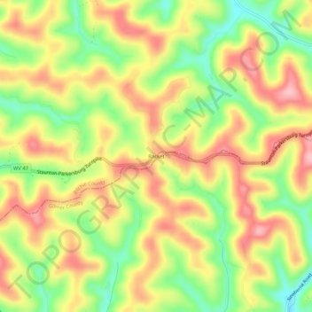
Name: Racket topographic map, elevation, terrain.
Location: Racket, Ritchie County, West Virginia, United States (39.02425 -80.95705 39.06425 -80.91705)
Average elevation: 325 m
Minimum elevation: 244 m
Maximum elevation: 396 m
Thank you for supporting this site ❤️
Make a donation
Make a donation
Other topographic maps
Click on a map to view its topography, its elevation and its terrain.