
Alto Peru topographic map
Click on the map to display elevation.
About this map
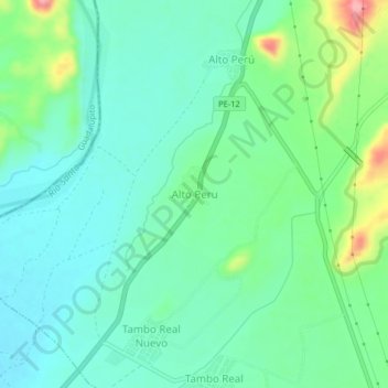
Name: Alto Peru topographic map, elevation, terrain.
Location: Alto Peru, Chimbote, Santa, Áncash, Perú (-8.96921 -78.59990 -8.92921 -78.55990)
Average elevation: 62 m
Minimum elevation: 28 m
Maximum elevation: 159 m
Other topographic maps
Click on a map to view its topography, its elevation and its terrain.