
Chli Rinderhorn topographic map
Interactive map
Click on the map to display elevation.
About this map
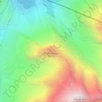
Name: Chli Rinderhorn topographic map, elevation, terrain.
Location: Chli Rinderhorn, Leukerbad, Leuk, Wallis, 3954, Schweiz (46.42564 7.64315 46.42574 7.64325)
Average elevation: 2,506 m
Minimum elevation: 1,900 m
Maximum elevation: 3,446 m
Other topographic maps
Click on a map to view its topography, its elevation and its terrain.
Rinderhorn
Rinderhorn, Leukerbad, Leuk, Wallis, 3954, Schweiz
Average elevation: 2,730 m
Daubenhorn
Daubenhorn, Leukerbad, Leuk, Wallis, 3954, Schweiz
Average elevation: 2,319 m