
Thank you for supporting this site ❤️
Make a donation
Make a donation
Emahmime topographic map
Click on the map to display elevation.
Thank you for supporting this site ❤️
Make a donation
Make a donation
About this map
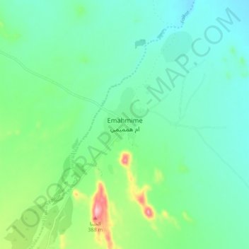
Name: Emahmime topographic map, elevation, terrain.
Location: Emahmime, Northern Red Sea Region, Eritrea (17.34262 38.50865 17.42262 38.58865)
Average elevation: 333 m
Minimum elevation: 277 m
Maximum elevation: 516 m
Thank you for supporting this site ❤️
Make a donation
Make a donation
Other topographic maps
Click on a map to view its topography, its elevation and its terrain.