
Thank you for supporting this site ❤️
Make a donation
Make a donation
Cheviot Hills topographic map
Click on the map to display elevation.
Thank you for supporting this site ❤️
Make a donation
Make a donation
About this map
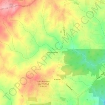
Name: Cheviot Hills topographic map, elevation, terrain.
Location: Cheviot Hills, Douglas County, Georgia, United States (33.57733 -84.88577 33.61733 -84.84577)
Average elevation: 325 m
Minimum elevation: 254 m
Maximum elevation: 386 m
Thank you for supporting this site ❤️
Make a donation
Make a donation