
Thank you for supporting this site ❤️
Make a donation
Make a donation
Black Oak topographic map
Click on the map to display elevation.
Thank you for supporting this site ❤️
Make a donation
Make a donation
About this map
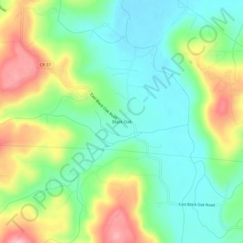
Name: Black Oak topographic map, elevation, terrain.
Location: Black Oak, Washington County, Arkansas, United States (35.96341 -94.09965 36.00341 -94.05965)
Average elevation: 427 m
Minimum elevation: 367 m
Maximum elevation: 533 m
Thank you for supporting this site ❤️
Make a donation
Make a donation
Other topographic maps
Click on a map to view its topography, its elevation and its terrain.