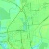
Olivehurst topographic map
Click on the map to display elevation.
About this map

Name: Olivehurst topographic map, elevation, terrain.
Location: Olivehurst, Yuba County, California, United States (39.05537 -121.59178 39.13537 -121.51178)
Average elevation: 19 m
Minimum elevation: 9 m
Maximum elevation: 27 m
Other topographic maps
Click on a map to view its topography, its elevation and its terrain.

Beale AFB
United States > California > Yuba County
On 15 October 1964, the Department of Defense announced that Beale would be the home of the new, supersonic reconnaissance aircraft, the SR-71 Blackbird. The provisional 4200th Strategic Reconnaissance Wing (4200 SRW) activated on 1 January 1965 in preparation for the realignment, and the new wing received its…
Average elevation: 69 m


Plumas Lake
United States > California > Yuba County > Plumas Lake
Plumas Lake is located at 39°1′14.62″N 121°33′28.86″W / 39.0207278°N 121.5580167°W / 39.0207278; -121.5580167 (39.0207272, -121.5580176). According to the United States Census Bureau, the CDP of Plumas Lake covers an area of 11.84 square miles (30.7 km2), all land. It lies at an elevation…
Average elevation: 14 m